
On Thursday night, Andy and Marci hosted a delicious dinner at their beautiful home in Belleview and on Friday Sam, Andy, Marci, Georgia and Tom drove across the state from Belleview to Walla Walla, home of Whitman College, where Stu is a senior and star soccer player. Washington's topographical variety as we drove from the northwest of the state to the southeast corner was stunning. The far west of the state receives far more precipitation and therefore is green and lush, where the Cascade Mountains are blanketed with forests while the state's central and eastern regions are dry, almost arid. From west to east, Washington's status as an agricultural powerhouse was evident. Apple orchards, vineyards, seemingly endless wheat fields and livestock farms punctuated the state's vast open spaces, in some areas hilly, in others mountainous, in others broad and flat, drained by the mighty Columbia River and its tributaries.Washington is a leading lumber producer. Its rugged surface is rich in stands of Douglas fir, hemlock, ponderosa and white pine, spruce, larch, and cedar. The state is the biggest producer of apples, hops, pears, red raspberries, spearmint oil, and sweet cherries, and ranks high in the production of apricots, asparagus, dry edible peas, grapes, lentils, peppermint oil, and potatoes. Livestock and livestock products also make important contributions to total farm revenue. The southeast has fully emerged as one of the nations leading producers of quality wines, where vineyards and wineries have multiplied. Walla Walla, in the center of the wine producing region, is a lovely and prosperous town with numerous grand homes from the late 1800s and early 1900s. The bucolic Whitman College campus, with its mix of classic old Georgian buildings and interesting modern structures, is a gem that complements the charming old neighborhoods that surround it.

Broad plains stretch to the mountainsCapture Date: Sep 19, 2014 11:28 AM•Views: 20No comments yet. All fields are required, fill in the form. Comment successfully added. Comment
|
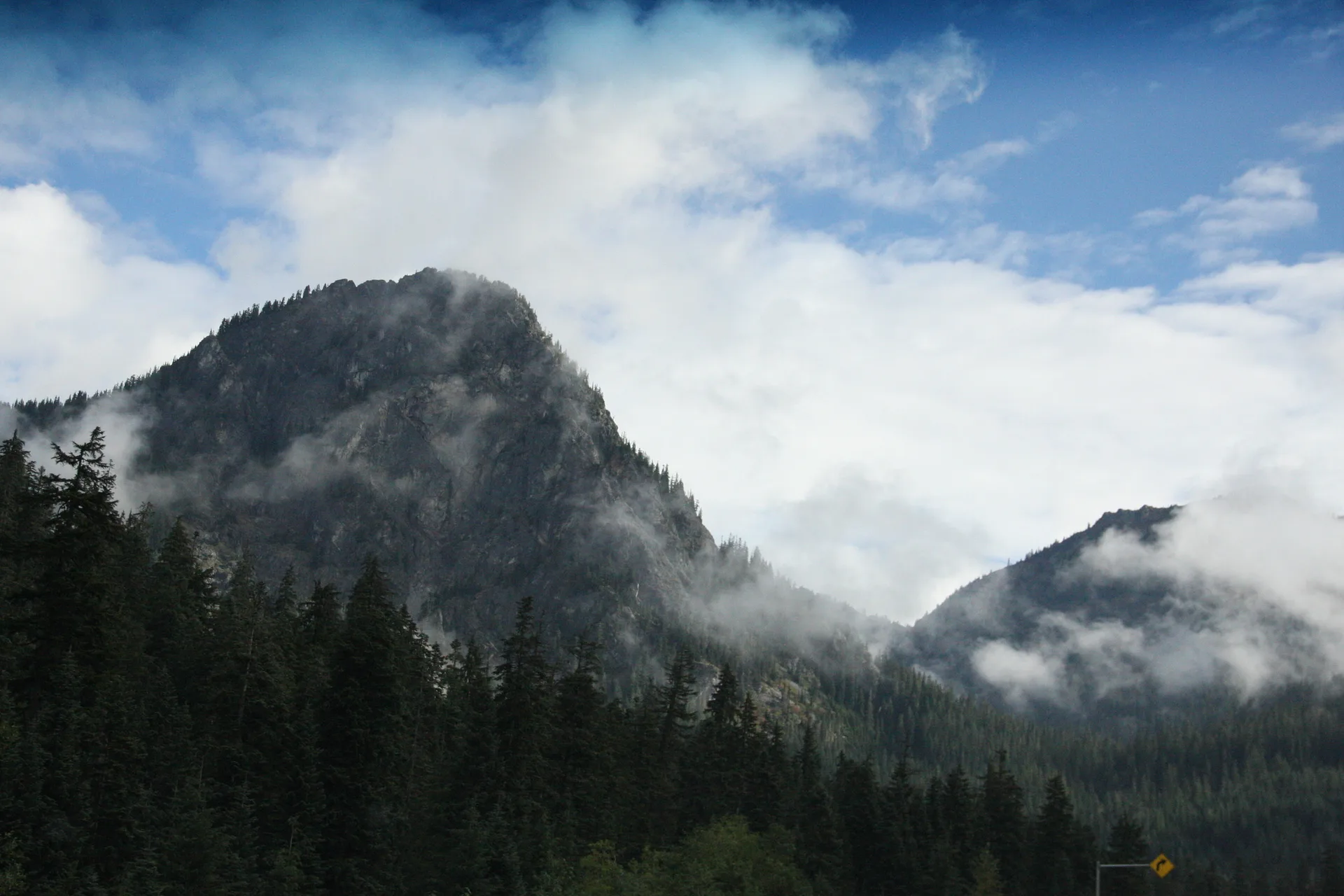
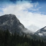
The sawtooth CascadesCapture Date: Sep 19, 2014 02:16 PM•Views: 21No comments yet. All fields are required, fill in the form. Comment successfully added. Comment
LaurieKelley Nov 18, 2014 04:46 PM
Read comment →
WOW! |
The CascadesCapture Date: Sep 19, 2014 02:16 PM•Views: 21No comments yet. All fields are required, fill in the form. Comment successfully added. Comment
|
Impressionistic rendering of a wind farmCapture Date: Sep 19, 2014 02:17 PM•Views: 22No comments yet. All fields are required, fill in the form. Comment successfully added. Comment
LaurieKelley Nov 18, 2014 04:47 PM
Read comment →
Very Cool |
Small farms, south central WashingtonCapture Date: Sep 19, 2014 02:17 PM•Views: 21No comments yet. All fields are required, fill in the form. Comment successfully added. Comment
|
Arid landscape-South Central WashingtonCapture Date: Sep 19, 2014 02:22 PM•Views: 22No comments yet. All fields are required, fill in the form. Comment successfully added. Comment
|
South Central WashingtonCapture Date: Sep 19, 2014 02:22 PM•Views: 22No comments yet. All fields are required, fill in the form. Comment successfully added. Comment
|
South Central WashingtonCapture Date: Sep 19, 2014 02:22 PM•Views: 20No comments yet. All fields are required, fill in the form. Comment successfully added. Comment
|
Mount Adams
The Cascade Range contains several volcanoes, which reach altitudes significantly higher than the rest of the mountains. From the north to the south these volcanoes are Mount Baker, Glacier Peak, Mount Rainier, Mount St. Helens, and Mount Adams. Mount St. Helens is currently the only Washington volcano that is actively erupting; however, all of them are considered active volcanoes. Mount Rainier, the tallest mountain in the state, is 50 miles south of Seattle, from which it is prominently visible
Capture Date: Sep 19, 2014 02:22 PM•Views: 20
No comments yet. All fields are required, fill in the form. Comment successfully added. Comment
|
Harsh scrub lands, south central WashingtonCapture Date: Sep 19, 2014 02:29 PM•Views: 20No comments yet. All fields are required, fill in the form. Comment successfully added. Comment
|
Mount Rainier as viewd from just north of Yakima
Mount Rainier is a massive stratovolcano located 54 miles southeast of Seattle. It is the most topographically prominent mountain in the contiguous United States and the Cascade Volcanic Arc, with a summit elevation of 14,411 ft Mt. Rainier is considered one of the most dangerous volcanoes in the world. Because of its large amount of glacial ice, Mt. Rainier could potentially produce massive lahars that would threaten the whole Puyallup River valley. ("Lahar" is a Javanese word that describes volcanic mudflows or debris flows that are composed of a slurry of pyroclastic material, rocky debris, and water. The material flows down from a volcano, typically along a river valley. Lahars are extremely destructive: they can flow tens of yards per second, be 460 ft deep, and destroy any structures in their path)
Capture Date: Sep 19, 2014 02:31 PM•Views: 23
No comments yet. All fields are required, fill in the form. Comment successfully added. Comment
|
Mt Adams
Mount Adams is a potentially active stratovolcano in the Cascade Range. It is the second-highest mountain in the U.S. state of Washington, trailing only Mount Rainier. Adams is a member of the Cascade Volcanic Arc, and is one of the arc's largest volcanoes, located in a remote wilderness approximately 31 miles east of Mount St. Helens. The Mount Adams Wilderness comprises the upper and western part of the volcano's cone. The eastern side of the mountain is part of the Yakama Nation.
Capture Date: Sep 19, 2014 02:32 PM•Views: 21
No comments yet. All fields are required, fill in the form. Comment successfully added. Comment
|
Approaching Yakima. Mt Ranier in the distanceCapture Date: Sep 19, 2014 02:32 PM•Views: 21No comments yet. All fields are required, fill in the form. Comment successfully added. Comment
|
Mighty Mt. Ranier
Mount Rainier was first known by the Native Americans as Talol, or Tacoma or Tahoma, from the Lushootseed word meaning mother of waters" spoken by the Puyallup people. The current name was given by George Vancouver, who named it in honor of his friend, Rear Admiral Peter Rainier. The map of Lewis and Clark expedition of 1804-1806 refers to it as "Mt. Regniere".
Capture Date: Sep 19, 2014 02:33 PM•Views: 20
No comments yet. All fields are required, fill in the form. Comment successfully added. Comment
|
A dry gulch near Yakima, South Central WashingtonCapture Date: Sep 19, 2014 02:33 PM•Views: 39No comments yet. All fields are required, fill in the form. Comment successfully added. Comment
|


No comments yet...
All fields are required, fill in the form.
Comment successfully added.
Comment